US Hwy 68 / KY 55 (New Lebanon Road) at KY 3211 (Palestine Road), Campbellsville, Kentucky
This 12.6-acre tract sits at the intersection of US Highway 68 / KY 55 (New Lebanon Road) and KY 3211 (Palestine Road) on the west side of Campbellsville, at the point where the Campbellsville Bypass currently ends. Stratford Group acquired the property in September 2023 on the strength of its corner position and the corridor plans around it.
Kentucky's enacted 2026–2032 Highway Plan includes Item No. 4-80257.00: a 2.62-mile extension of KY 3350 (the Campbellsville Bypass) from KY 289 to US 68 on the east side of Campbellsville. The plan funds design in FY 2028, right-of-way in FY 2030, utility relocation in FY 2031 and construction in FY 2032, for a total of about $19.8 million. Stratford Group's understanding is that the new road will run through or adjacent to this property to connect with KY 3211 and continue to KY 3350 (North Bypass Road). When that link is built, the tract will sit on a continuous bypass loop around Campbellsville, with the traffic counts and visibility that support fuel and convenience, restaurant, retail and mixed-use development.
The property lies in Taylor County outside the Campbellsville city limits and is not subject to zoning. Recorded restrictions apply but do not limit commercial uses of this kind.
Fuel and convenience, quick-service and sit-down restaurant, neighborhood retail, medical or professional office, hospitality, and mixed-use development. Stratford Group will consider a sale of the whole tract, pad-site sales, ground leases or a joint development.
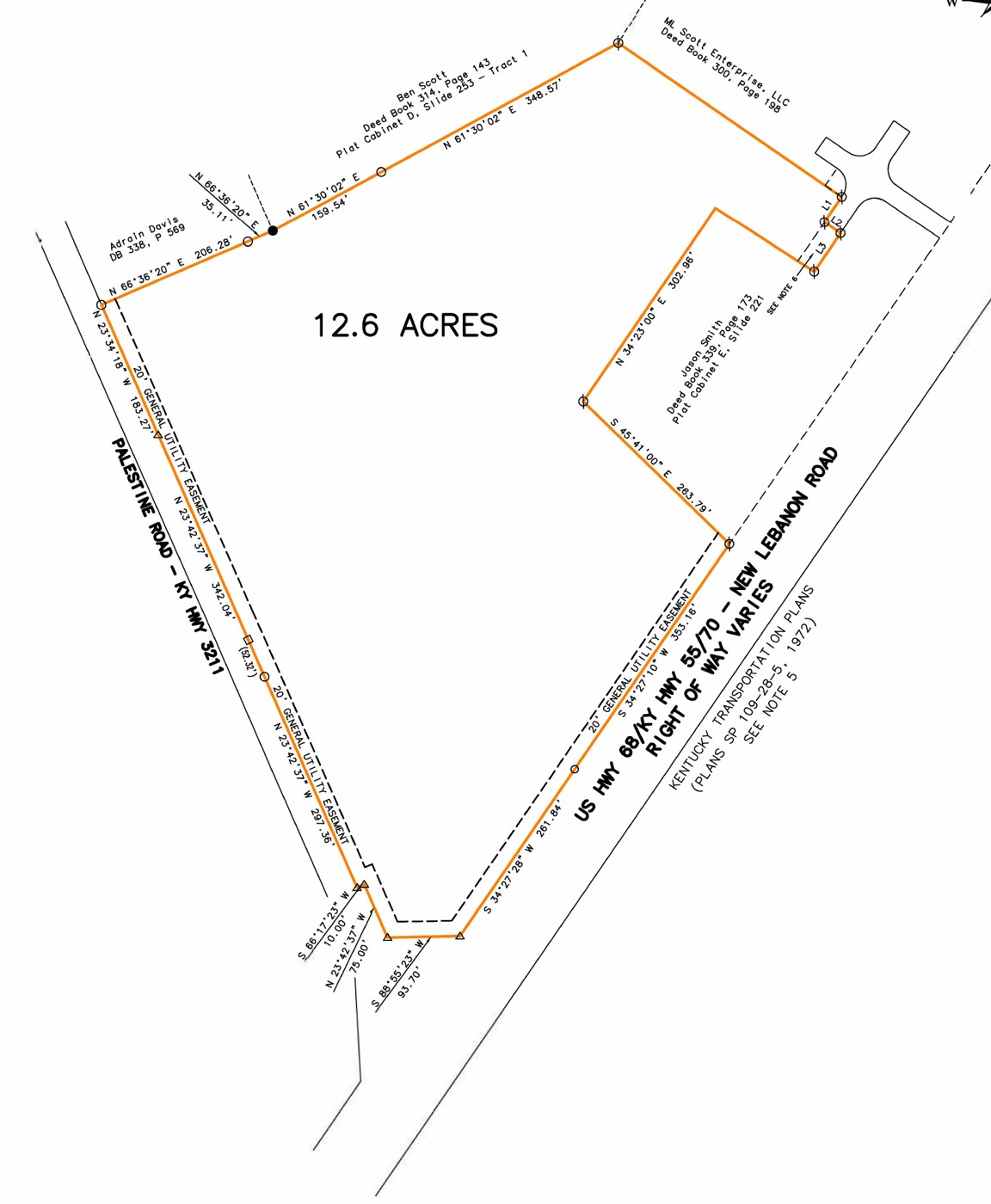
Plat of survey, July 2023. Download the full survey (PDF).
Coordinates: 37.37164, -85.30551. Highway Plan information is from the 2026 Regular Session enactments (HB 502 and HJR 75). The final alignment has not been published and is subject to change by the Kentucky Transportation Cabinet.